
Seep no. 18 - Don’t multiply entities beyond necessity - pastel on paper - 16”H x 36”W
The notion of Occam’s Razor came back into my thinking recently, and I’ve rediscovered how helpful it is as a way (as I understand it, anyway) to approach the challenges I encounter day-to-day.
I realized it was time (after several years) to fix my not-closing studio door. I hadn't even looked at it over the course of years to begin the process of determining what was wrong, let alone what I needed to do to repair it. I hopped on YouTube. The videos suggested ruling out the simple stuff first (the “is it plugged in” kind of questions). So I went through the steps, and the second step did the trick. After years of this door not fully closing, I simply needed to shim a hinge. That was it. I felt both embarrassed and victorious in my now-warmer studio!
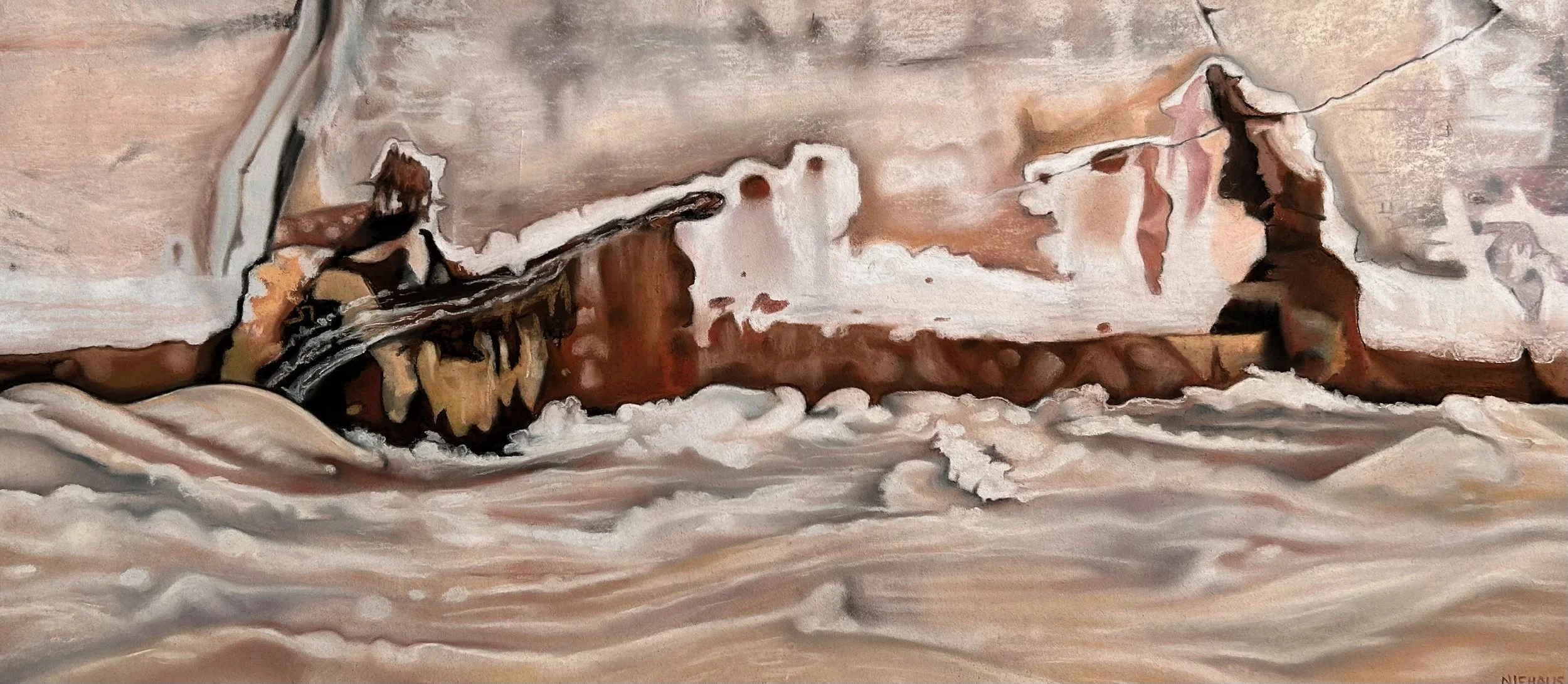
Another example: As I studied the naturally occurring seep featured in this painting, I saw two figures. The figures have a relationship to each other: they’re looking at each other, but they’re not quite connecting. Not seeing eye to eye. I focused on this aspect for a while, which left me in a pessimistic mood. It was just an illustration of not being on the same page with someone. How is that helpful?
But on a different kind of day, I focused on the fact that while they weren’t connecting, they were pretty close to doing so. That it wouldn’t take much for them to adjust their views in the direction of alignment.
Relationships are dynamic! When things aren’t clicking, it’s easy to assume the worst - that the dysfunction is coming from a tangled knot of complicated problems, that things are so broken they probably can’t be repaired. That could be true! But it’s more likely that it’s something basic that needs to be tweaked. It’s worth exploring, every time, if perhaps you just need to return to the basics of your relationship, to the stuff you know works. Like listening.